Drone activities in the network
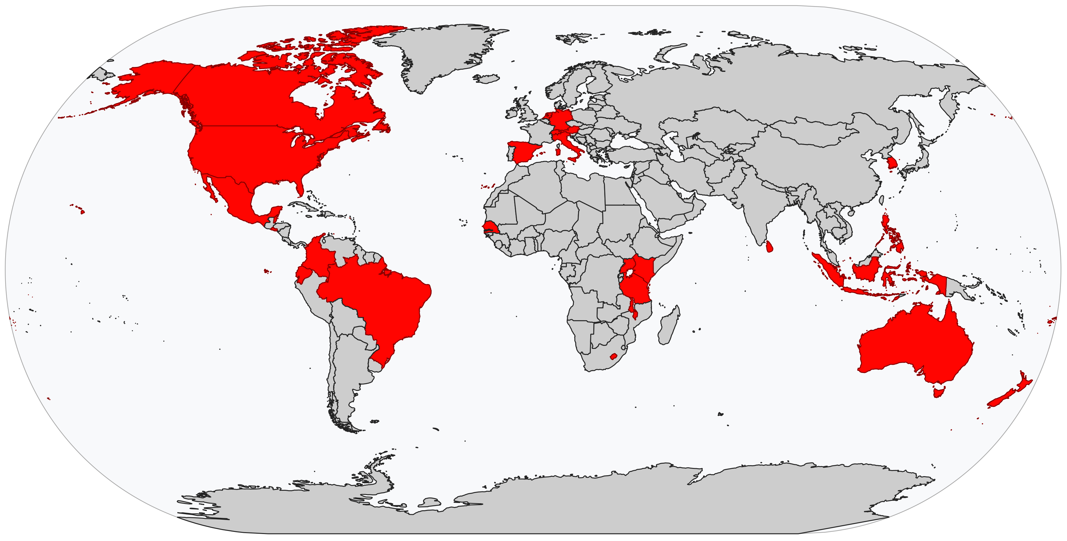
Fig. 6 Countries where the National Society has undertaken activities with drones.
American Red Cross
Drones used for: Initial research into drone use, post-disaster situational awareness, mapping.
Operational examples: The American Red Cross used drones domestically for the first time during Hurricanes Harvey and Irma in September 2017. Since 2017, the American Red Cross International Services Department GIS/Data Team has used UAS for mapping activities in collaboration with other societies: these mapping projects have taken place in the Philippines, Haiti, and Belize.
Summary: In 2014, representatives of the American Red Cross attended the first United Nations Advisory Round Table on humanitarian UAV technology. In April 2015, the American Red Cross and UAS consulting firm Measure released a joint study entitled “Drones for Disaster Response and Relief Operations.” The report described potential use cases for the technology, policy recommendations for the development of favorable UAS regulations, and technical information. 1
Since 2017, the International Services Department (ISD) GIS/Data Team has used UAS for several mapping activities in their work with other National Societies. At present, however, there is not an overall, organization-wide strategy for integrating UAS into American Red Cross activities domestically.
In May 2017, the ISD GIS/Data Team used UAS to map 23 barangays in Leyte, Philippines for creation of more detailed OpenStreetMap (OSM) data to be used for disaster management activities. In December 2017, the team used UAS to map 35 sq km of Canaan, Haiti to update the OSM data for the rapidly urbanizing landscape. In January 2019, the team led a community mapping training with Belize Red Cross that included sessions on the use of UAS for mapping.
The first real-world deployment of a drone by the American Red Cross domestically took place in September 2017, as part of the response to Hurricane Harvey in the US state of Texas. In a project funded by the United Parcel Service’s charitable wing, Red Cross workers collaborated with drone-makers CyPhy Works to use their tethered UAS to gain situational awareness and capture photographs of hurricane damage.
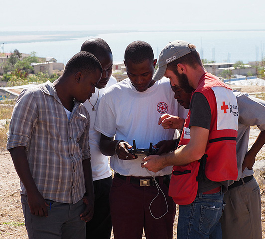
Fig. 7 Dan Joseph from American Red Cross shows members of the Haitian Red Cross how to pilot a drone. | Credit: Matthew Gibb, American Red Cross.
Australian Red Cross
Drones used for: Initial policy research into drone use.
Operational examples: None reported.
Summary: In 2016, the Australian Red Cross, the Australian Government and the International Federation of the Red Cross sponsored drone organization WeRobotics to study the suitability of UAS technology for disaster response operations in the South Pacific. The final report, released in June 2018, noted the importance of “integrating data into decision making processes” and the importance of “evidence-based decision making” when assessing UAV performance: the report also stressed the importance of considering location-specific and contextual factors when considering the use of UAVs in disaster response.
Austrian Red Cross
Drones used for: Search and rescue, situational awareness.
Operational examples: Public demonstrations of UAS capabilities, in collaboration with Austrian K9 search and rescue units.
Summary: The Austrian Red Cross UAS project was initiated in January 2017, after the Austrian Red Cross won a Land Rover competition with a UAV-focused car design. Vehicle and proprietary UK-made drone were delivered soon afterwards under auspices of “Project Hero”, launching a still-continuing 2 year experimental phase. The Austrian Red Cross now uses both the Land Rover UAS and multiple other consumer UAS (largely DJI products). The Austrian Red Cross has not yet deployed the UAS in real-world disaster and SAR settings, largely due to a lack of relevant disaster and SAR incidents as well as restrictive Austrian UAS regulations. The ARC has carried out regular trainings and demonstrations with the UAS, and currently have 10 certified drone pilots, as well as a standardized training system.
Belize Red Cross Society
Drones used for: Community mapping efforts, disaster resilience work.
Operational examples: Using drones to make maps of multiple communities around Belize City, in support of community mapping efforts for disaster resilience.
Summary: The Belize Red Cross Society uses drones primarily for community mapping exercises and for community disaster resilience preparation In its first operational use of drones, the Belize Red Cross initially planned to use drones to map 16 communities in the vicinity of Belize City. The Red Cross drone pilots worked with other Belizean organizations to conduct mapping exercises, including the Belizean Ministry of Natural Resources, the Lands and Geology Department, and the National Emergency Management Organization. Drone data was used to augment out-of-date Google maps, and to help communities develop disaster risk awareness and planning strategies, giving them a “big picture” view of their homes. The Belize Red Cross hopes that communities will use these maps and the training provided to them as a means of developing “sustainable” disaster response systems and strategies: they also hope that the UAS-created maps will be shared throughout the Belize emergency management community when the next disaster hits.
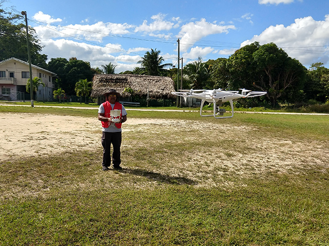
Fig. 8 Terence Woodye of the Belize Red Cross practices flying a DJI Phantom drone. | Credit: Dan Joseph, American Red Cross.
Brazilian Red Cross
Drones used for: Post-disaster mapping, public relations photographs.
Operational examples: In 2017, the Brazilian Red Cross used drones to search for potential mosquito breeding locations, as part of efforts to fight Dengue fever and Zika virus in urban areas. 2
Summary: The Brazilian Red Cross currently uses drones to support post-disaster mapping operations, as well as for general situational awareness efforts. Drones are also used to take photographs for promotional materials.
The Canadian Red Cross Society
Drones used for: Video and photographs for public relations and communications, situational awareness, post-disaster mapping.
Operational examples: Collecting video footage of the scale of the Kutapalong Refugee Camp in Bangladesh, for use in the “Safe for Humanity” informational campaigns.
Summary: The Canadian Red Cross Society has shot drone photos and video in many countries around the world, including Bangladesh, Mozambique, Haiti, South Sudan, Uganda, Congo, Nepal. This aerial imagery is largely used to support public messaging and communications campaigns. Drone imagery was also used to facilitate overall operational awareness during the Mozambique flood response in 2019.
Colombian Red Cross Society
Drones used for: Post-disaster mapping, search and rescue.
Operational examples: Mapping for emergency response operations after the Mocoa landslide in 2017.
Summary: The Colombian Red Cross Society began integrating drones into their operations in 2016. Initially it was thought to use drones to support search and rescue activities. The National Society has leveraged staff and volunteers who have been trained and certified personally and voluntarily by their own means. In 2017, drones were used in support of emergency response operations after the Mocoa landslide by mapping the area, helping to assess the magnitude of the tragedy and allowing a contextual analysis to ensure staff safety. In 2018, the Colombian Red Cross team participated in a drone training coordinated by WFP. In 2020, the Cundinamarca Branch plans to participate in a training that focuses on the use of drones for risk management, emergency response, and search and rescue operations.
Ecuadorian Red Cross
Drones used for: Post-disaster mapping, community mapping.
Operational examples: Post-disaster mapping after Quito landslide.
Summary: The Ecuadorian Red Cross acquired its first drone in November 2018, with funding from a disaster forecasting financing project. The DJI Mavic Pro was then used for VCA risk assessment work and community mapping. Risk maps are combined with hand-drawn maps to give a comprehensive view of possible disaster. Drone imagery was also collected for disaster assessment purposes during the Quito landslide.
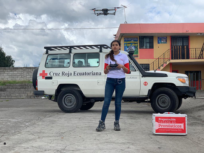
Fig. 9 Drone deployment for mapping vulnerable communities in Cotopaxi Province, Ecuador. | Credit: Ecuadorian Red Cross National Disaster Risk Reduction Program.
Fiji Red Cross Society
Drones used for: Damage-assessment mapping, post-disaster photography and video.
Operational examples: Pacific Flying Labs, in coordination with the Fiji Red Cross Society, attempted to use a Phantom 4 Professional drone to document damage from Tropical Cyclone Keni in the Kadavu Region in April 2018. Ultimately, high winds prevented the drone from being flown safely in the area.
Summary: Tropical Cyclone Keni hit Fiji on April 10th 2018, causing widespread damage across the island. The Fiji Red Cross Society and Pacific Flying Labs worked together to collect images of the village of Manuana, combining on-foot surveys and aerial mapping techniques. 3
German Red Cross
Drones used for: Search and rescue, situational awareness.
Operational examples: The German Red Cross Kreisverband Limburg (a district association of the German Red Cross) has used its DJI Matrice 200 drone during four SAR operations at the time of writing. On one occasion, the drone was used to search for signs of a sinkhole in an area where an explosion attributed to unexploded ordnance took place. The drone was used to look at the area to evaluate risk to fire teams. On a second occasion, the drone was used to assess an ongoing 11 acre-wide fire in a national park area. Additionally, the drone was used to assist with searching for missing people on two different occasions.
Summary: The German Red Cross Kreisverband Limburg is actively experimenting with UAS technology at this time to support SAR operations with dogs, facilitate fire department situational awareness, create maps of disaster areas, and to provide lighting for search teams on dark nights. The organization hopes to use UAS equipped with thermal sensors to enhance visual searches for missing people. Additionally, the organization is working with UgCS specialized software for drone search and rescue operations, which facilitates extensive, comprehensive searches using drones over wide areas. 4
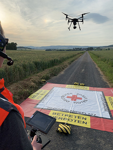
Fig. 10 Drone take off in Ahlbach, Germany, 2019. | Credit: Kai Brunner, German Red Cross - Kreisverband Limburg e.V..
Indonesian Red Cross Society
Drones used for: Disaster resilience mapping, IDP camp planning, vulnerability and capacity assessment support.
Operational examples: The Indonesian Red Cross Society (Palang Merah Indonesia - PMI) has used its DJI Phantom 4 Professional drone on a number of real-world missions. These include mapping a displaced person’s camp in Sulawesi, creating orthomosaic maps of Malaku, supporting earthquake readiness projects in Java, and more.
Summary: The Indonesian Red Cross (PMI) acquired its first drone in early 2017, hoping to use it to create high-quality and up-to-date photographic maps, or orthomosaics. The organization has since flown its DJI Phantom 4 Professional drone throughout the country, largely in support of disaster risk resilience (DRR) and Vulnerability and Capacity Assessment (VCA) activities. The high-quality drone imagery they collect helps PMI and community leaders to better identify potential disaster risks and dangers before they take place.
PMI uses open platforms OpenStreetMap (OSM) and OpenAerialMap (OAM) to create community maps and to ensure that the drone data they collect is available for public use. Its first project used drones to create orthomosaic maps of areas of the island of Malaku for disaster risk reduction purposes: these maps were uploaded to OpenAerialMap and used for OpenStreetMap mapping activities. Drone imagery enables PMI to help communities create better, more up-to-date and accurate maps than they might otherwise have access to, giving them a more accurate “big picture” view of their communities and the potential disaster risks they face.
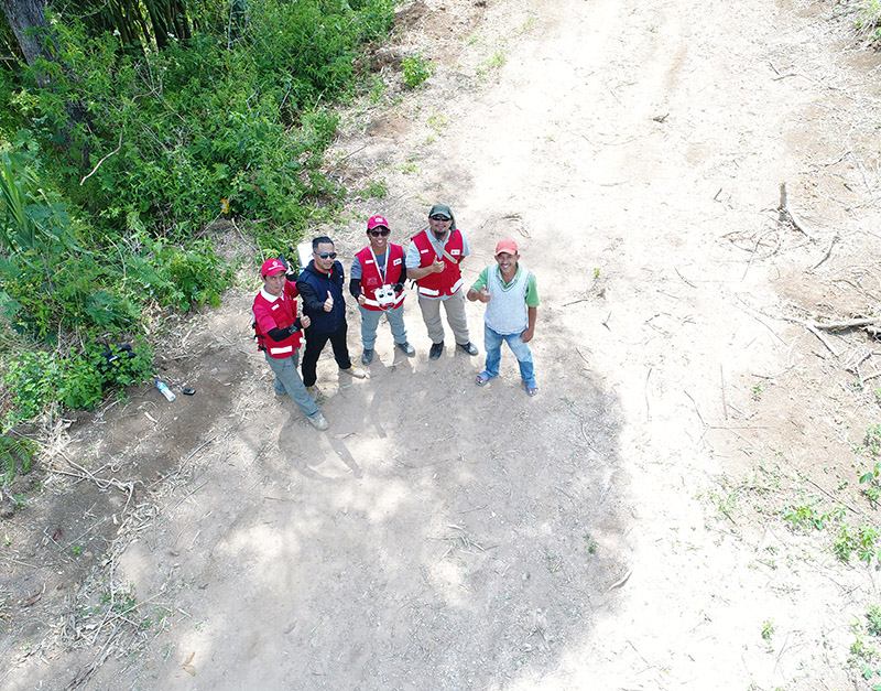
Fig. 11 Team picture taken using the drone. | Credit: PMI.
International Committee of the Red Cross (ICRC)
Drones used for: Mapping, infrastructure planning.
Operational examples: None at this time.
Summary: The ICRC has developed a number of policy documents related to drone technology in recent years. The 2017 ICRC Data Protection Handbook included specific guidance related to the ethical use of drone data. In 2019 in Mozambique, the ICRC conducted limited, non-operational testing of drone technology. The ICRC plans to conduct proof-of-concept drone technology tests in 2020. One such test is planned in Juba, South Sudan: drones will be used to map and plan water infrastructure. The ICRC hopes to build a small air operations team: from there, it hopes to train “all the units to have their own pilot certified by Air Operations.”
Eventually, the ICRC may operate regional drone “hubs” which will enable units to quickly access drone technology when they need it, without requiring that they purchase a drone themselves. The ICRC is also interested in potentially working with outside partners to collect drone data, such as Flying Labs. In its experiments going forward, the ICRC will be emphasizing data security and data protection, and will pay special attention to how it might ethically operate UAS in conflict areas and in complex emergencies.
Italian Red Cross
Drones used for: Search and rescue.
Operational examples: 2015 experimental joint exercise in Turin area.
Summary: Desk research indicates that the Italian Red Cross used a drone with Red Cross insignia on it in 2015. 5 This appears to be linked to a November 2015 joint exercise between the Italian Red Cross and the Politecnico of Turin, in which medical teams and engineers used a thermal-camera equipped drone to assist with a simulated search and rescue operation. 6 In 2016, the Italian Red Cross in Bologna announced a collaboration with the UK-based telematics provider Octo on a “drone intelligence service” for emergency rescue operations. 7 In 2017, the Italian Red Cross opened am RPAS training centre in Bologna. In 2020, the training centre was recognized as “state flight” by the national civil aviation authority (ENAC). 23
Kenya Red Cross Society
Drones used for: Mapping, agricultural monitoring, risk mapping, disaster response.
Operational examples: Recent Kenyan Red Cross drone missions (with mentorship from Canadian companies DAC and Altohelix) include: creating drone maps of the Dadab refugee camp, documenting shelter reconstruction efforts and crop health monitoring in Kilifi, flood response and documentation in Moyale, flood search and resuce in West Pokot, and flood risk mapping in Narok County.
Summary: In June 2017, the Kenyan Red Cross used drone footage provided by the Red Cross Red Crescent Climate Centre to convey the scale of flooding in the Ewaso Ngiro river basin. 8 The Kenyan Red Cross began its own drone program in early 2019, working closely with Canada-based companies DAC Aviation and Altohelix. The drone program’s goal is to build in-house drone-piloting and drone data-analysis capacity amongst Kenyan Red Cross staff both at headquarters and amongst regional teams. Ultimately, it hopes to be able to provide drone services to the broader humanitarian community, including UNHCR: it also hopes to work with drone-delivery technology (dependent upon the loosening of Kenya’s current, strict, drone regulations). Currently, the program works with 2 drone models: the DJI Mavic 2 Enterprise and the Mavic Pro 2, as well as the ArcGIS, Pix4D, and OpenDroneMap software packages.
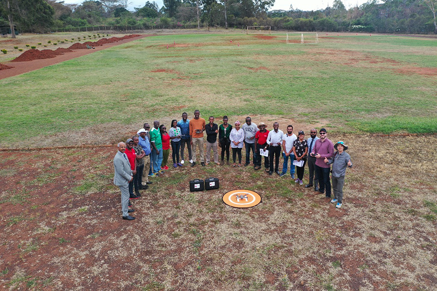
Fig. 12 Kenya Red Cross Society Initial Pilot Training for the RPAS unit with DJI Mavic drones in April 2019 with DAC Aviation, Altohelix corporation, and Kenya Civil Aviation Authority. | Credit: Kenya Red Cross Society.
Korean Red Cross
Drones used for: Health.
Operational examples: Used a drone to disinfect high-risk spots when combating COVID-19. 9
Summary: In March 2020 when combating COVID-19, the Korean Red Cross used a drone to disinfect high-risk spots at the Red Cross Hospital in Gyeongsang-do.
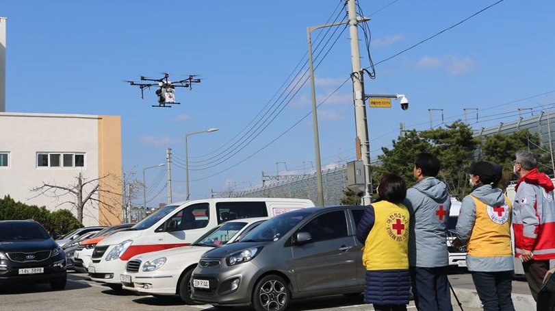
Fig. 13 Drone launch. | Credit: Korean Red Cross.
Lesotho Red Cross Society
Drones used for: Mapping, pre-disaster mapping.
Operational examples: Participation in a 2018 training conducted by Tanzania Flying Labs and WeRobotics, with support from World Vision International. 10
Summary: The Lesotho Red Cross Society (LRCS) and World Vision International took part in a 3-day Tanzania Flying Labs/WeRobotics training focused on using drones to acquire and analyze aerial imagery. The training emphasized the creation of drone maps of disaster areas for use in Community Disaster Preparedness Plan (CDPP) development, as well as drone use for rapidly mapping disaster areas for assessment purposes.
Malawi Red Cross Society
Drones used for: Pre-disaster mapping.
Operational examples: Participation in cholera response mapping exercise using drones with UNICEF and LUANAR University. Drones used as part of assessment efforts in response to 2019 flooding. Drone mapping and flood risk assessment work in collaboration with the Netherlands Red Cross in 2018.
Summary: The Malawi Red Cross Society participated in a UNICEF cholera risk mapping project using drones in early 2018, in conjunction with LUANAR university. 11 In 2019, Malawi experienced extensive flooding: as part of the disaster response process, the Malawi Red Cross Society, the Malawi Department of Disaster Management Affairs (DODMA), and UNICEF used drones to capture assessment data in inaccessible areas. 12 13 14 In 2018, the Malawi Red Cross Society worked with the Netherlands Red Cross Society to secure permission to fly from Malawi’s Civil Aviation Authority (CAA): later in 2018, the two Societies collaborated on flood mapping efforts using drone data in the Chikwawa area. In 2017, the Malawi Red Cross Society was one of a group of national and local stakeholders who attended a WeRobotics training on the integration of UAV technology into disaster response efforts. 15
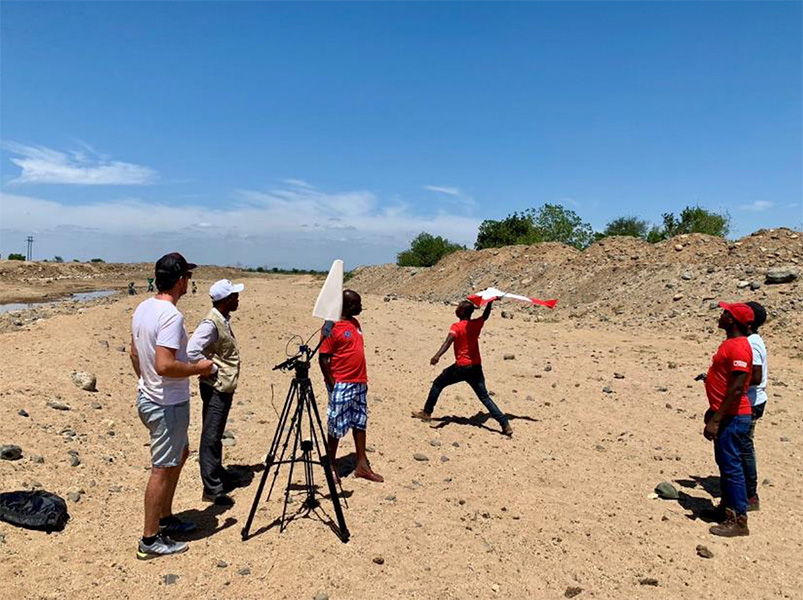
Fig. 14 Launch of the Freya drone. | Credit: Malawi Red Cross Society.
Mexican Red Cross
Drones used for: Damage assessment and search and rescue, with particular emphasis on supporting staff safety and facilitating better decision-making.
Operational examples: Search and rescue and damage assessment work during the 2016 Ecuador earthquake. Damage assessment work during response to Hurricane Matthew in Haiti in 2016. Search and rescue and assessment work during the 2017 Mexico City earthquake. Damage assessment work during the response to the 2018 Guatemalan volcanic eruption.
Summary: The Mexican Red Cross has worked with drones since 2014, when it acquired its first Phantom 2. Since then, the Mexican Red Cross has used drones on multiple occasions during real-world disaster response incidents, including the 2016 Ecuador earthquake, during Hurricane Matthew in 2016 in Haiti, as part of the response to the 2017 Mexican earthquake, and during the response to the 2018 Guatemalan volcano. The Mexican Red Cross uses drones primarily for post-disaster damage assessment and for search and rescue purposes.
The Netherlands Red Cross
Drones used for: Post-disaster mapping and damage assessment, flood risk assessment for disaster resilience.
Operational examples: Damage assessment and mapping in St Maarten following Hurricanes Irma and Maria in 2017. Flood risk mapping and assessment in collaboration with the Malawi Red Cross in 2018. Drone pilot training participation in Sweden in 2018.
Summary: In 2016, the Netherland’s Red Cross humanitarian data-focused 510 Initiative began to experiment with drone technology: 510 team members began to learn to fly drones and to process drone data. In September 2017, the Netherlands Red Cross used a Phantom 4 Professional drone to take photographs of hurricane damage on St Maarten, following Hurricanes Irma and Maria. Drone data was used to conduct damage assessment of buildings, identify roof types and materials, and to better inform the building of shelters.
In early 2018, the Netherlands Red Cross worked with the Malawi Red Cross to assist that organization with securing permission to fly from Malawi’s Civil Aviation Authority.
Later in 2018, the Netherlands Red Cross worked with the Malawi Red Cross to conduct a 10-day mapping mission in Malawi’s Chikwawa area. The organizations used drone data to conduct flood analysis,and to analyze potential risk from future flooding. Also in 2018, the Netherlands Red Cross participated in a 5-day drone pilot training in Sweden.
The Netherlands Red Cross is currently planning drone mapping missions in the Philippines, in coordination with Philippines Flying Labs.
New Zealand Red Cross
Drones used for: The NZRC hopes to use drones for sea-based search and rescue and disaster assessment.
Operational examples: None yet.
Summary: The New Zealand Red Cross began to explore drone technology in 2018, with the intention of using drones to get better data into the hands of disaster managers. Currently, the NZRC is working towards developing a drone mapping and search and rescue program capable of operating throughout the Pacific region. It hopes to work with engineers and university researchers to develop sophisticated machine-learning supported data collection and analysis pipelines, better methodologies for aerial disaster response assessment, and more sophisticated hardware adapted to the watery Pacific environment, like drones capable of conducting long-range mapping and search and rescue missions from water-based “lily pads.” The program is currently working with Pacific airway administrators and officials to secure permission to operate on a cross-Pacific basis. The NZRC has acquired DJI Mavic drones, and is working towards acquiring funding for a staff training program.
Philippine Red Cross
Drones used for: Community mapping, disaster preparedness mapping.
Operational examples: Community mapping efforts in May 2017 in support of a recovery project.
Summary: In response to the devastation caused by Typhoon Haiyan in 2013, the Phillippine Red Cross and the American Red Cross partnered on Tindog Tabang Leyteño, a 3-year recovery project dedicated to building safer, more resilient communities. In May 2017, the project used drones (an Event 38 E384, a Tuffwing UAV Mapper, and a DJI Mavic Pro) to create updated, high-resolution maps of project focus areas. 16
In November 2018, the Nokia company announced that it would be supplying the Philippine Red Cross with “portable LTE networks, and artificial intelligence (AI) and analytics tools” to ” help with disaster recovery” as part of Nokia’s Nokia Saving Lives (NSL) initiative. 17 In December 2019, the Philippine Red Cross announced a new collaboration with US-based drone delivery company Zipline: the project intends to use the Philippines as a base for the “the largest drone delivery operation for blood and medical supplies in the Asia-Pacific region through Zipline,” and is slated to launch in the summer of 2020. 18
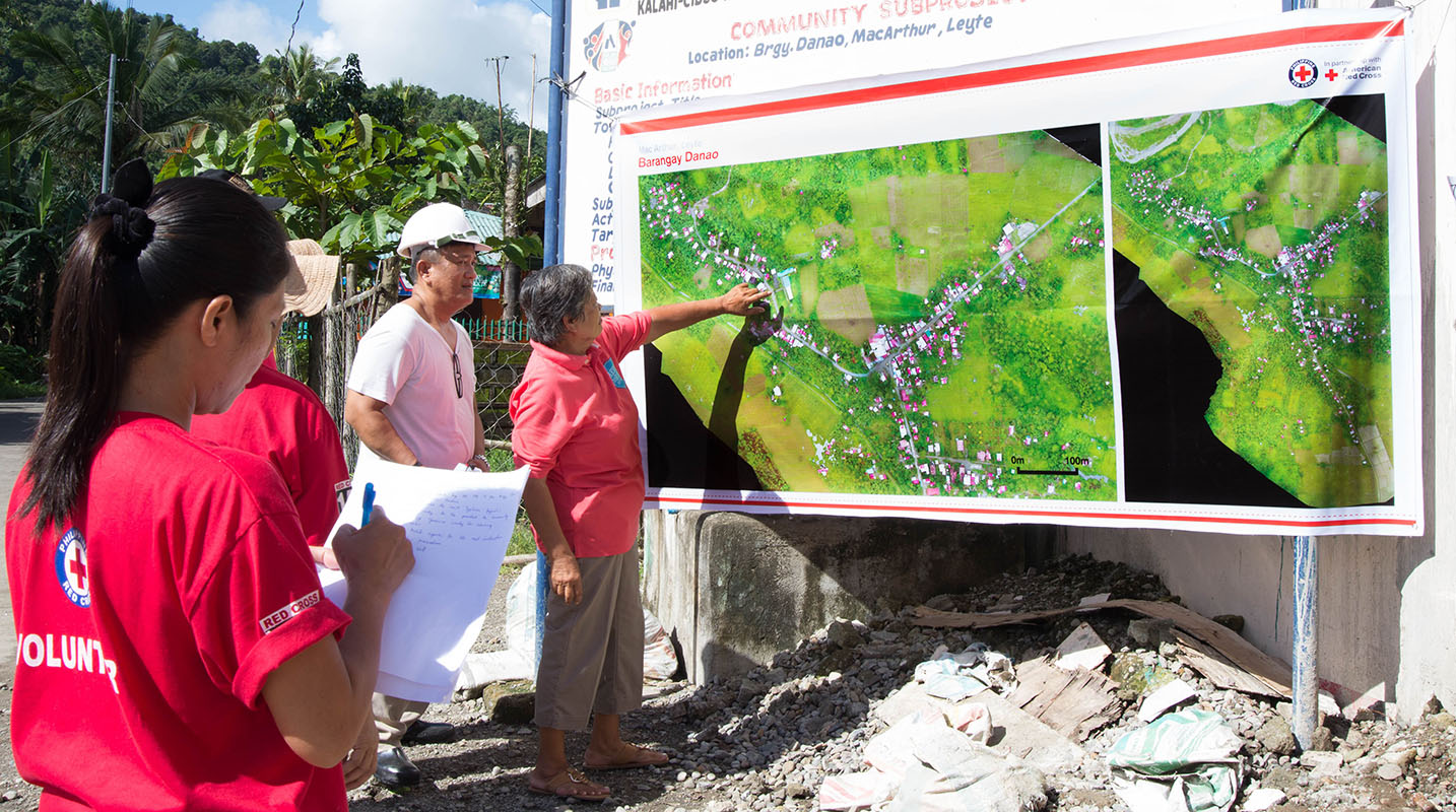
Fig. 15 Barangay officials refer to drone imagery during a disaster planning exercise. | Credit: Ylla De Ocampo, Philippine Red Cross.
Salvadorean Red Cross Society
Drones used for: Communications and PR, training.
Operational examples: Limited use of two drones for capture of photographs and video of field operations and events for communications, as well as training exercises.
Summary: The Salvadorean Red Cross is in the early stages of incorporating drone technology into its damage assessment operations: it is “interested in working to have these devices that help to carry out risk mapping and to support emergency operations, especially in search and rescue.”
Salvadorean Red Cross members are learning more about the uses of new technology in disaster mapping, and have run simulations of damage assessment procedures and protocol. In 2019, the Swiss Red Cross visited El Salvador and conducted a presentation and demonstration of risk-mapping drone technology.
The El Salvador Red Cross currently owns two drones: one is used by communications staff to document field visits and events with photographs and video, while the other is used exclusively for training.
Senegalese Red Cross Society
Drones used for: Training.
Operational examples: None yet.
Summary: Senegal Flying Labs/We Robotics is currently working with the Senegalese Red Cross Society to provide initial training and support for future drone operations. They hope to use UAS to produce pre-disaster and post disaster maps. They do not currently have their own drones, but hope to acquire them in the future with Senegal Flying Labs assistance.
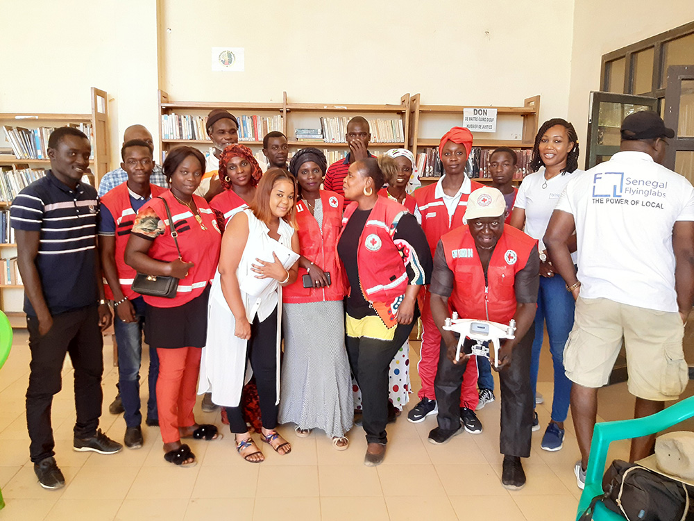
Fig. 16 Senegalese Red Cross and Flying Labs briefing with volunteers before assessment. | Credit: Mamadou Gueye, Senegalese Red Cross.
Spanish Red Cross
Drones used for: Search and rescue, situational awareness, mapping.
Operational examples: In October 2017, the Spanish Red Cross used drones in a search and rescue pilot project at a beach in Tenerife. This initial pilot project has been followed by a number of other search and rescue pilots in different environments, including lakes, mountains, and more sea rescues. Some Spanish Red Cross branches currently use drones to record simulated emergency exercises.
In 2018, during the response to the Indonesian earthquakes, the Spanish Red Cross deployed an information management field assessment coordination team (IM FACT) to map IDP camps in Sulawesi: the Spanish Red Cross worked with teams from the Indonesian Red Cross Society and the IFRC to use a Phantom 4 Pro drone to collect map data.
Summary: The Spanish Red Cross first used drones in October 2017, as part of a search and rescue pilot project: the drone was used to deliver a RFD (rescue floatability device) to a distressed person in the ocean. In June 2018, the Spanish Red Cross created a working group to “assess [the technology], define the drone requirements, and create procedures.” In 2018, the Spanish Red Cross was involved with drone mapping efforts at IDP camps in Sulawesi, as part of the response to the Indonesian earthquakes. Currently, the working group consists of 4 volunteer drone pilots and 3 disaster management officers. As of this writing, the Spanish Red Cross has carried out multiple pilot projects involving drones, primarily using the aircraft to assist in search and rescue operations. The SPRC is involved in a 5G pilot project with assistance from Vodafone and Altran: search and rescue teams are testing an app that enables their drones to more effectively stream video, night video, and thermal imagery.
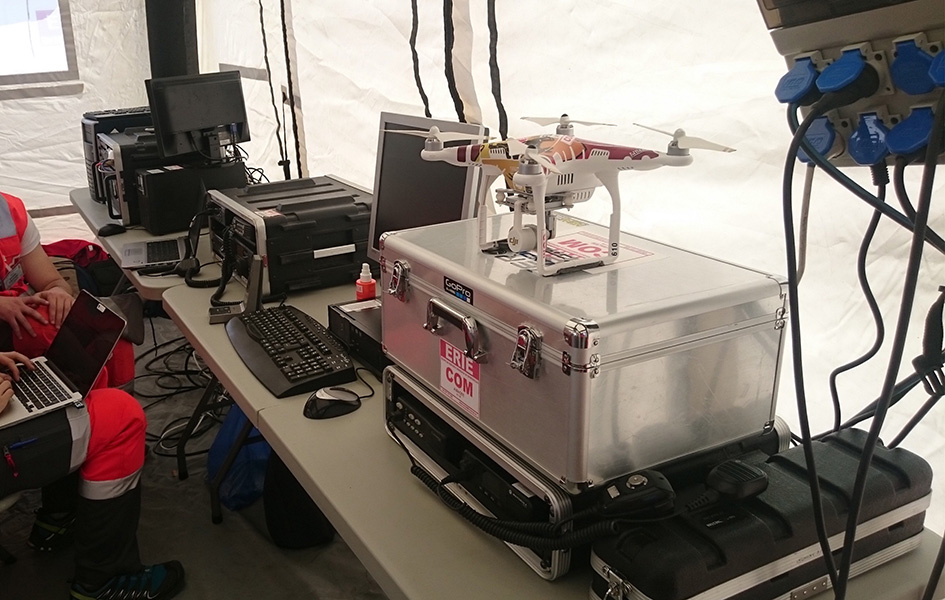
Fig. 17 Albacete’s IT & Telecom Domestic Emergency Response Team Equipment at the Spanish Red Cross Advanced Control Post, during the SIMEX with the Military Emergency Unit in Torrelavega, April 2017. | Credit: Spanish Red Cross.
The Sri Lanka Red Cross Society
Drones used for: Flood mapping, pre-disaster mapping, disaster planning, climate change planning.
Operational examples: Drone used to assess damage from monsoon flooding in 2018.
Summary: The Sri Lanka Red Cross Society is currently using UAV mapping as part of a risk-reduction strategy for climate change, as highlighted in a IPCC report from 2018. 19 In May 2018, the Sri Lankan Red Cross announced that the Colombo branch had used a waterproof Swell Pro quadcopter-style drone to assess damage from monsoon flooding. 20
Tanzania Red Cross National Society
Drones used for: Pre-disaster mapping, disaster planning, flood mapping.
Operational examples: 2015 participation in flood-risk reduction mapping exercises.
Summary: In 2015, the World Bank and Drone Adventures used UAVs to capture imagery of flood-prone areas in Dar es Salaam, in a consortium flood risk-reduction project 21 with the Tanzania Red Cross National Society, the Commission for Science and Technology (COSTECH), the Swedish Development Agency, and the Global Facility for Disaster Risk Reduction. 22
The Uganda Red Cross Society
Drones used for: Post-disaster mapping and situational awareness, as well as limited use for monitoring population movement.
Operational examples: Drone mapping of October 2018 landslide, aiding disaster assessment efforts. Drone video of refugee movement across border collected in 2016.
Summary: In September 2016, the Uganda Red Cross Society used drone footage to document the scale of the humanitarian response at the Bidibidi refugee reception centre, in what was widely heralded as the first use of a drone by the Red Cross Red Crescent on the African continent. In October 2018 in response to the Bududa landslides, the Uganda Red Cross Society worked with Uganda Flying Labs to use drones to collect data for situational awareness and mapping. The Uganda Red Cross Society was pleased with the resulting data, and hopes to build its own internal drone capacity in the near future. However, Ugandan UAS policies are restrictive: the Uganda Red Cross Society hopes to obtain official permission from aviation authorities to fly more often.
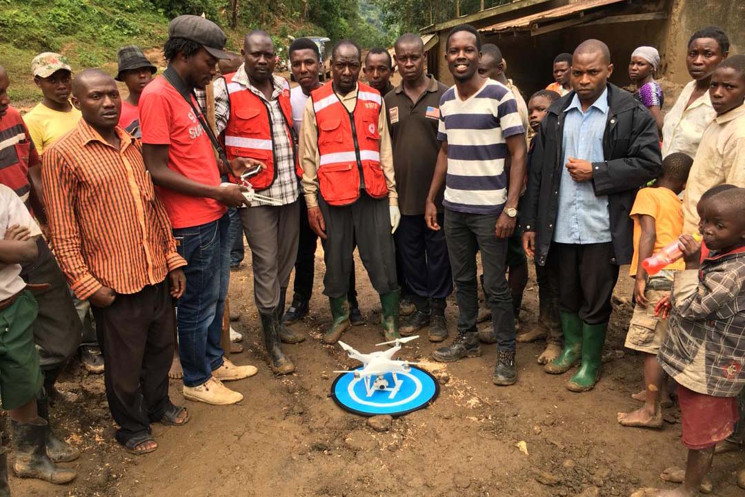
Fig. 18 Uganda Flying Labs, Uganda Red Cross, and community members. | Credit: Uganda Flying Labs.
Footnotes
- 1
Measure, American Red Cross. “Drones for Disaster Response and Relief Operations.” April, 2015. https://www.issuelab.org/resources/21683/21683.pdf.
- 2
“Technology in the hand and in the sky helps prevent the spread of Zika,” IFRC.org. 2016. https://www.ifrc.org/ar/news-and-media/news-stories/americas/brazil/technology-in-the-hand-and-in-the-sky-helps-prevent-the-spread-of-zika-72080/?print=true.
- 3
Amrita Lal. “Pacific Flying Labs Deploys with Fiji Red Cross After Major Cyclone.” WeRobotics. May 24, 2018. https://blog.werobotics.org/2018/05/24/pacific-labs-deploys-red-cross/
- 4
“German Red Cross Strengthens Search and Rescue Capability with UgCS Drone Software.” DroneBelow. January 23, 2019. https://dronebelow.com/2019/01/23/german-red-cross-strengthens-search-and-rescue-capability-with-ugcs-drone-software/
- 5
“Roma Drone 2015, Rome Urbe Airport. Drone of the Italian Red Cross in flight.” Alamy. May 28, 2015. https://www.alamy.com/rome-roma-drone-2015-rome-urbe-airport-drone-of-the-italian-red-cross-in-flight-italy-image179247631.html
- 6
Laura Novaro Mascarello, Fulvia Quagliotti, Mario Bertini. ” An unmanned search and rescue mission.” EGU General Assembly 2016, held 17-22 April, 2016 in Vienna Austria, id. EPSC2016-7124. https://ui.adsabs.harvard.edu/abs/2016EGUGA..18.7124N/abstract
- 7
Wiliam Payne. “Octo drone telematics for emergency rescue.” IoT M2M Council. November 8, 2016. https://www.iotm2mcouncil.org/octoteleer
- 8
” Drone footage highlights severity of drought in Kenya?s Ewaso Ngiro river basin.” IFRC. June 4, 2017. https://www.ifrcnewsroom.org/story/en/237/drone-footage-highlights-severity-of-drought-in-kenya-s-ewaso-ngiro-river-basin/792
- 9
IFRC Asia Pacific. Twitter. https://twitter.com/IFRCAsiaPacific/status/1235852877119160322
- 10
“Creating Community Disaster Preparedness Plans in Lesotho.” WeRobotics. December 7, 2018. https://blog.werobotics.org/2018/12/07/creating-community-disaster-preparedness-plans-in-lesotho/
- 11
Rebecca Phwitiko. “Drones for cholera response: innovating for children in Malawi.” UNICEF Malawi. Feb 26, 2018. https://medium.com/@unicef_malawi/drones-for-cholera-response-innovating-for-children-in-malawi-6dcab2c4de53
- 12
International Federation of Red Cross And Red Crescent Societies. “Malawi Floods: Emergency Plan of Action (EPoA) - DREF: MDRMW014 (11 February 2019).” ReliefWeb. Feb 11th, 2019. https://reliefweb.int/report/malawi/malawi-floods-emergency-plan-action-epoa-dref-mdrmw014-11-february-2019
- 13
Tautvydas Juskauskas. “Flying a drone in Malawi: My first emergency deployment.” UNICEF Connect. April 10, 2019. https://blogs.unicef.org/blog/flying-drone-malawi-my-first-emergency-deployment/
- 14
International Federation of Red Cross And Red Crescent Societies. “Emergency Appeal. Malawi: Floods”. ReliefWeb. April, 2019. https://reliefweb.int/sites/reliefweb.int/files/resources/EA-Malawi%20floods_210421_final.pdf
- 15
“Building Expertise in Humanitarian Drone Coordination in Malawi.” WeRobotics. December 14, 2017. https://blog.werobotics.org/2017/12/14/humanitarian-drone-coordination-malawi/
- 16
“Detailed drone and street-level imagery for mapping in the Philippines,” Missing Maps, July 27, 2017, https://www.missingmaps.org/blog/2017/07/27/drone-and-street-level-imagery-in-philippines/
- 17
James Blackman. “Nokia supplies UAVs, LTE, AI for disaster recovery in the Philippines,” Enterprise IOT Insights, November 27, 2018, https://enterpriseiotinsights.com/20181127/channels/news/nokia-supplies-disaster-recovery-in-philippines
- 18
Scott Garceau. “Bono teams up with Red Cross to deliver blood using drones.” The Philippine Star. December 11, 2019. https://www.philstar.com/headlines/2019/12/11/1976087/bono-teams-red-cross-deliver-blood-using-drones
- 19
“Sri Lanka Red Cross drone assesses monsoon disaster from the air.” Climate Centre. May 6, 2018. https://www.climatecentre.org/news/1003/sri-lanka-red-cross-drone-assesses-monsoon-disaster-from-the-air
- 20
“Disaster Response Units of Red Cross standing by to assist in case weather worsens.” Sri Lanka Red Cross Society. May 18, 2018. http://www.redcross.lk/main-news/disaster-response-units-of-red-cross-standing-by-to-assist-in-case-weather-worsens/
- 21
Julie Arrighi. “Dar es Salaam workshop charts future of inter-agency programme for flood resilience in Tanzanian commercial capital.” Climate Centre. November 14, 2016. https://www.climatecentre.org/news/799/dar-es-salaam-workshop-charts-future-of-inter-agency-programme-for-flood-resilience-in-tanzanian-commercial-capital
- 22
“World Bank Using UAVs for Disaster Risk Reduction in Tanzania.” OpenDRI. August 19, 2015. https://opendri.org/world-bank-using-uavs-for-disaster-risk-reduction-in-tanzania/
- 23
Centro Addestramento Nazionale SAPR (Sistemi di Aeromobile a Pilotaggio Remoto). https://www.cri.it/centroaddestramentodroni