What is aerial assessment?
Aerial assessment in disaster response
Aerial assessment, for the purpose of this study, is analysis processes conducted using remotely sensed data from orbital or aerial platforms to support humanitarian disaster response activities. Aerial assessment can be utilized for disaster preparedness but that is outside the scope of this study. The platforms used include satellites, manned aircraft such as planes or helicopters, and emerging technologies such as drones. The analysis processes are intended to improve situational awareness, coordination, identification of needs, and prioritization and allocation of resources. There are numerous challenges when conducting assessment in a disaster response including but not limited to: urgency, competing priorities, limited resources, access limitations, often rapidly evolving situations, and damaged infrastructure such as that for transportation and telecommunications. There are both limitations and opportunities in leveraging aerial assessment to capture information that might otherwise be invisible from the ground.
Orbital and aerial platforms
Satellites are capable of collecting images of large sections of the surface of the Earth from space. Due to the cost and challenges involved with operating satellites, imagery collection by satellite is generally conducted by governments or large commercial companies. The cost of purchasing imagery may be quite high; however, humanitarian organisations can often access satellite imagery through partnerships and other agreements at reduced cost or no-cost for the duration of a disaster response. The tasking of satellites, choosing what portion of the Earth’s surface to capture, may be prioritized based on the needs of paying customers or atmospheric conditions such as clouds and imagery of the right place and at the right time may not always be available. Depending on the satellites and sensors involved, the frequency of image capture for a given location as well as the resolution of the images can vary. The best resolution available is generally around 40cm (1 pixel in the image is equivalent to 40x40 cm on the ground). Changes in satellite technology are increasing resolutions and decreasing revisit times.
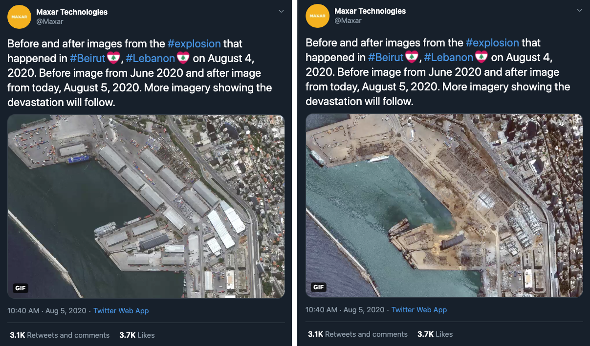
Fig. 1 Before and after images of the 2020 explosion in Beirut | Credit: Maxar Technologies, @Maxar_
Manned aircraft such as planes and helicopters can carry observers capable of recording notes during a flight and/or sensors such as cameras that may be mounted to the aircraft or carried by one of the people onboard. Though less expensive and more accessible than satellites, manned aircraft can still carry high costs, need infrastructure such as landing strips and refueling points, and require skilled maintenance technicians and pilots. Aircraft are more flexibly tasked than satellites and may be able to fly beneath certain atmospheric conditions such as cloud cover that obscurs views from a satellite. Proximity to the Earth’s surface also results in higher resolution imagery but reduced area coverage. Getting map-like images of large areas via aircraft requires specialized equipment and pilots.
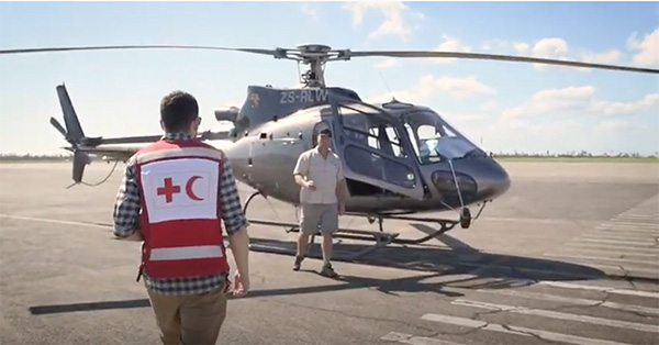
Fig. 2 A helicopter being used for assessment after Cyclone Idai in Mozambique | Credit: IFRC
As drones have moved from large systems that are only a tool of militaries, to smaller systems which are commercially available and affordable to average consumers, they have increasingly been used to capture images from the sky for activities such as humanitarian response. Drones can be easily transported and tasked, launched on short notice to take advantage of opportunities such as breaks in the weather, and can capture very high resolution images. However, drones are often limited to capturing only small areas by factors such as short battery life and altitude limitations imposed by aviation regulations, and can be damaged by rain or excessive wind. Despite these limitations there are examples such as Nepalese drone pilots mapping 138 kilometers of roads using a single drone like the one in the image below, and altitude restrictions are legal not technical so exemptions are simply a matter of establishing the right agreements and protocols.
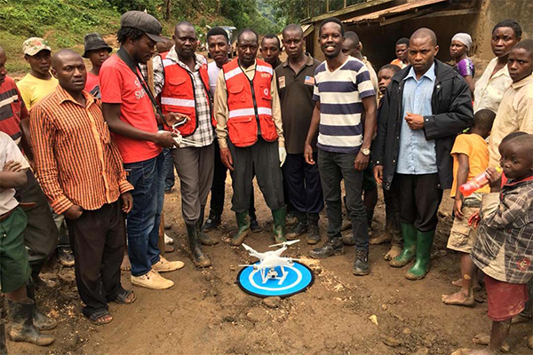
Fig. 3 Uganda Flying Labs, Uganda Red Cross, and community members | Credit: Uganda Flying Labs