Participatory GIS
What is it?
Geographic Data Collection
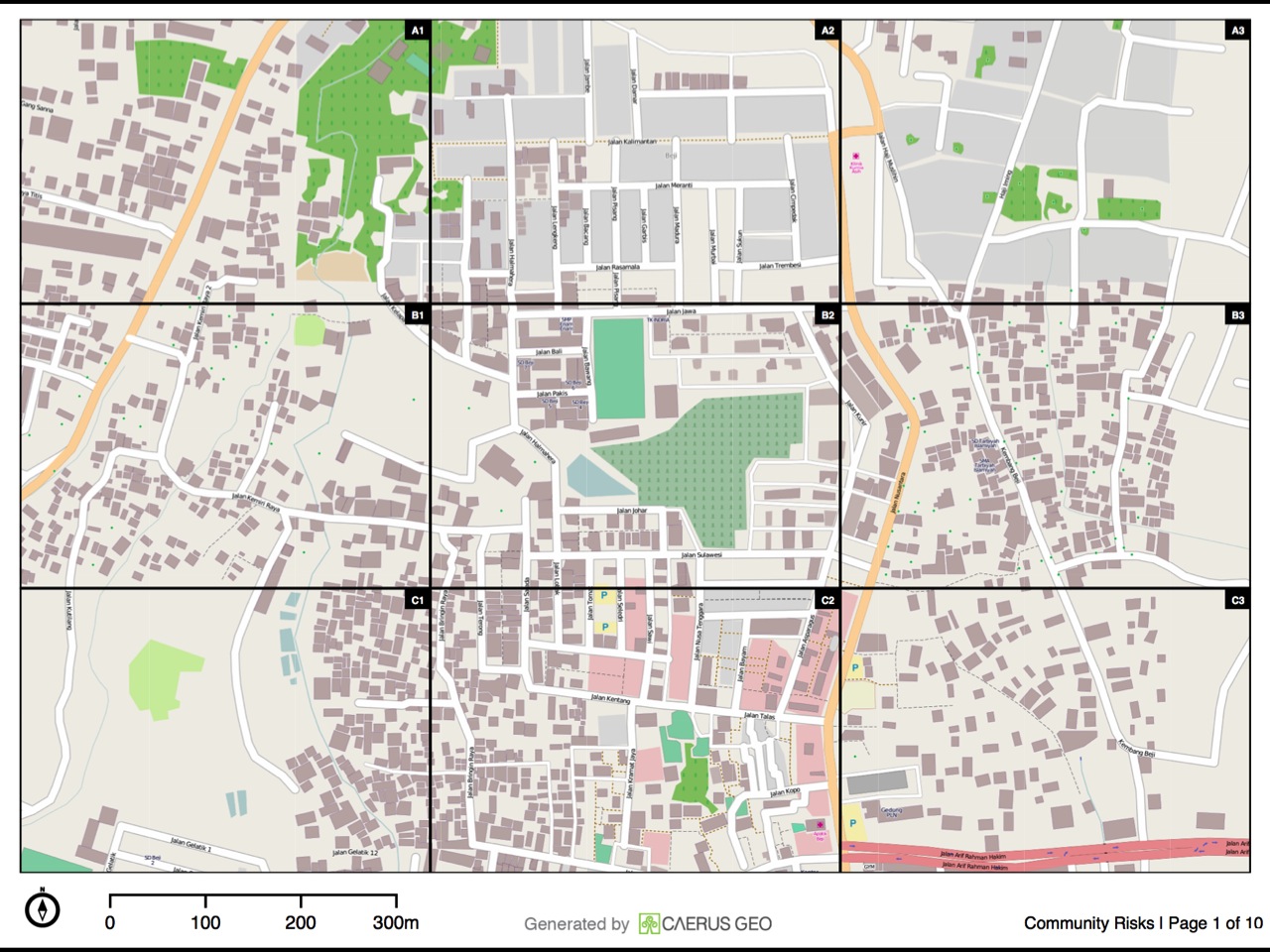
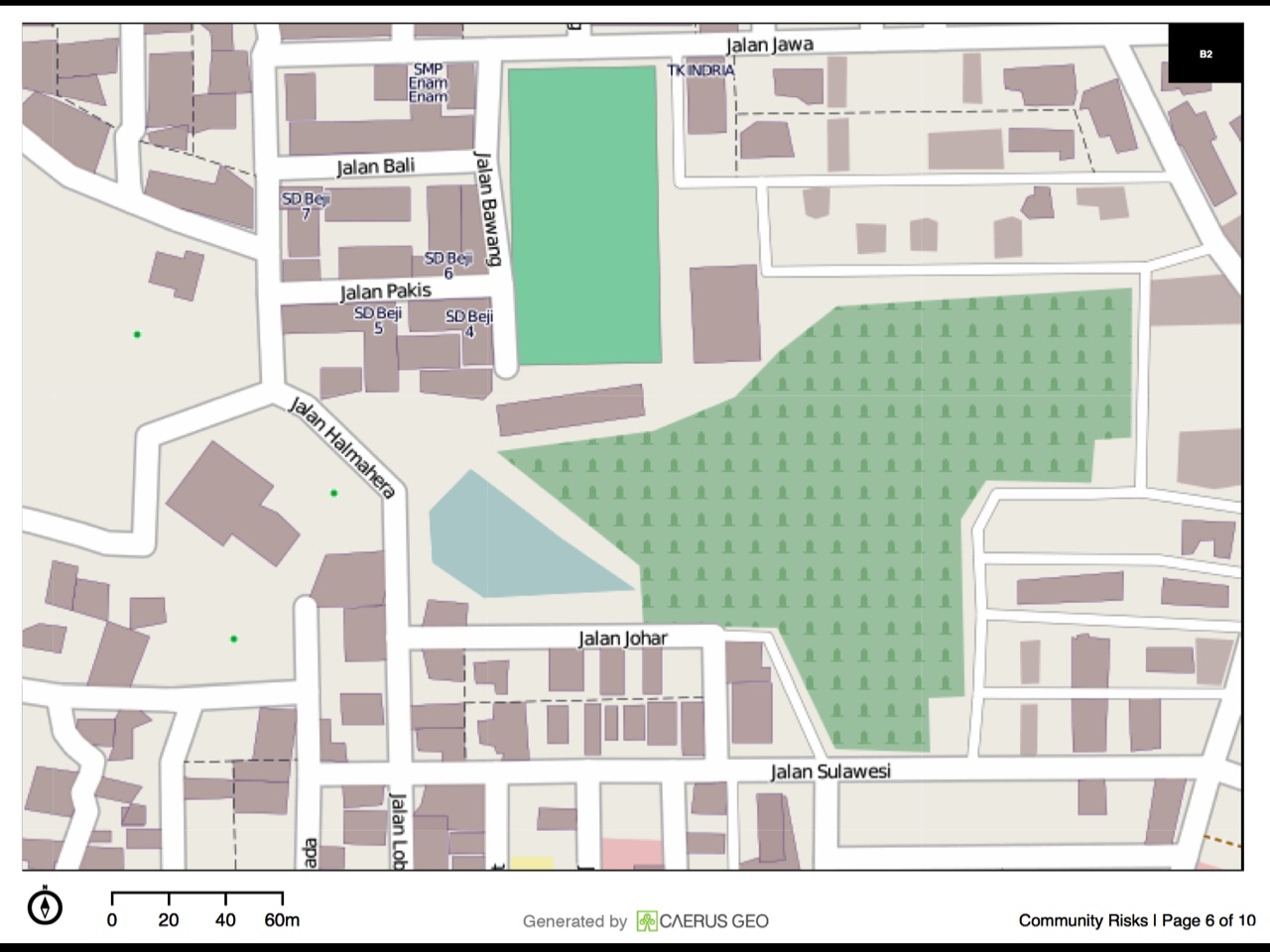
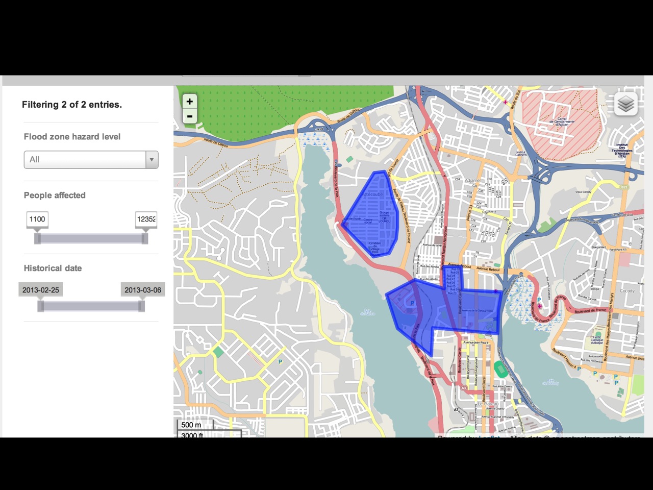
It’s a map
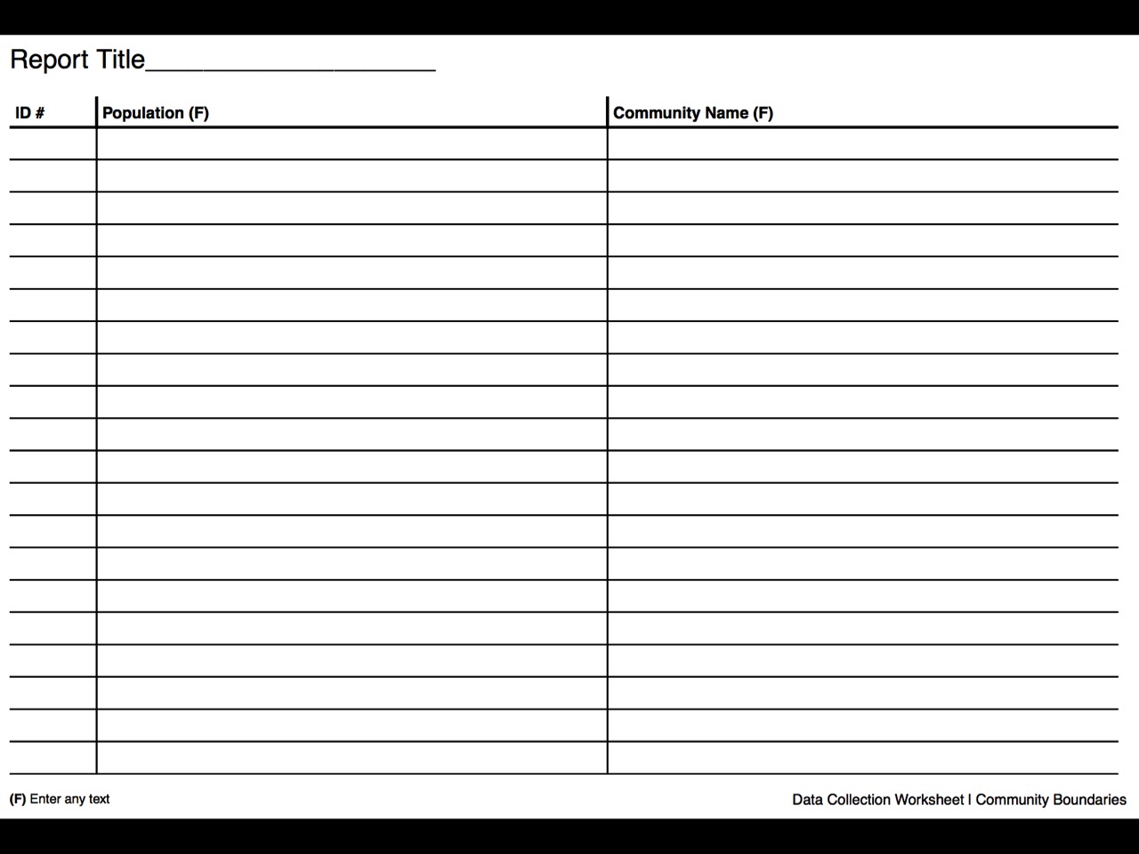
It’s a spreadsheet
How does it work?
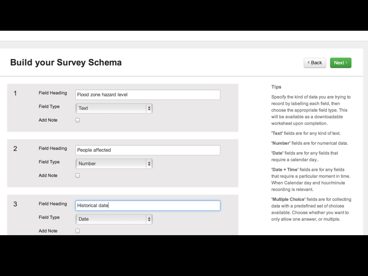
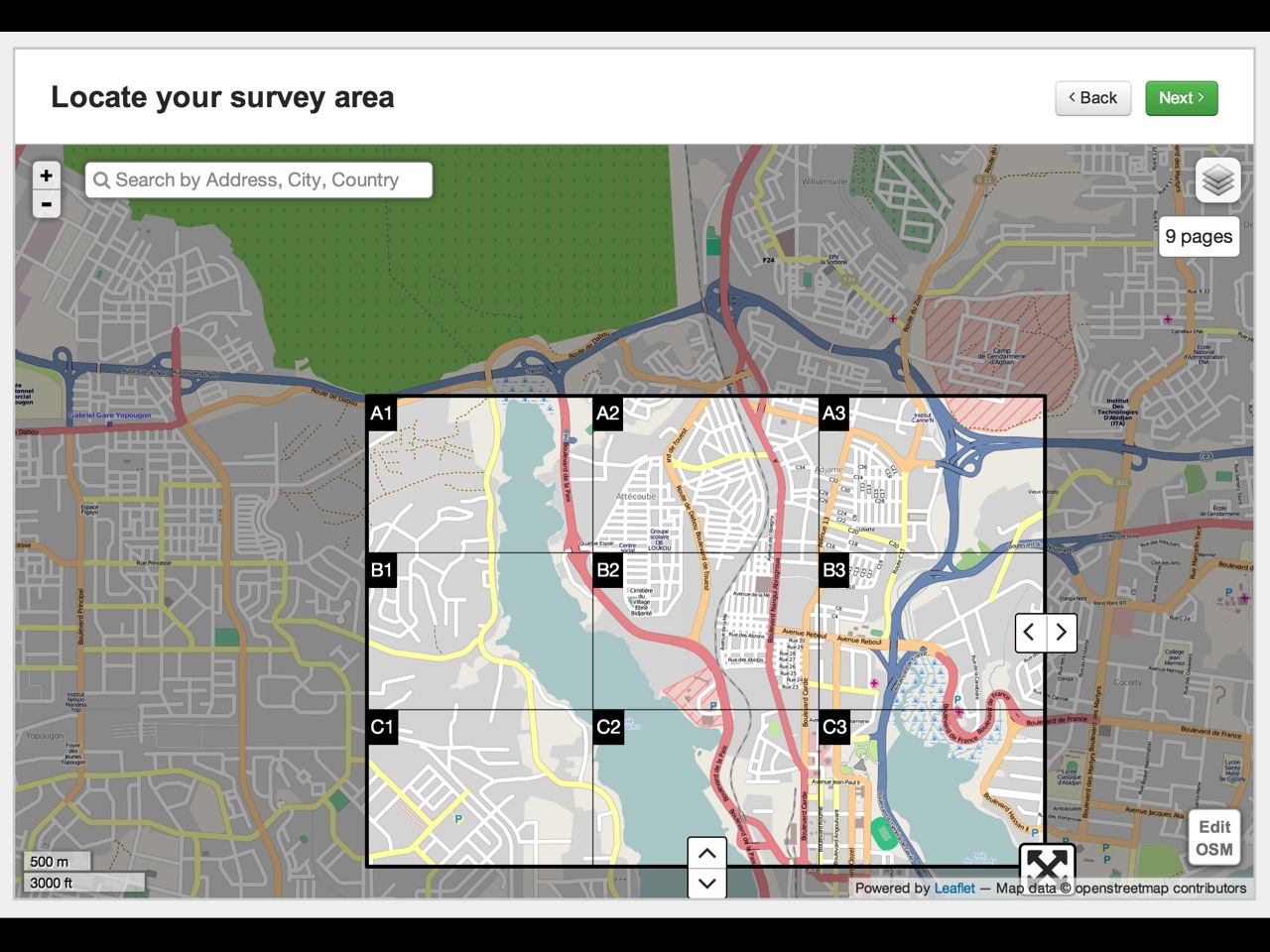
Design a “survey”
Make an atlas
Print
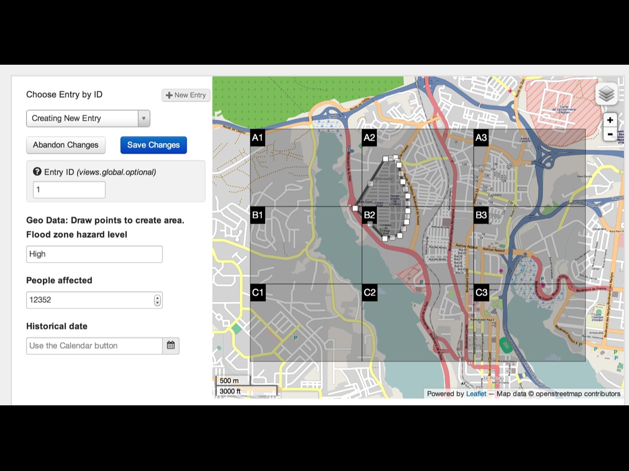
Collect data
Enter data
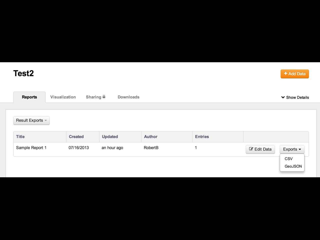
Export data
Print
Create GIS data
*
(without knowing a thing about GIS)
Who can use CaerusGeo?
Program staff
Red Cross Volunteers
Community members
Kids
Anyone who can use a computer
Anyone who can draw
Questions?